
Region
Arunachal Pradesh
The easternmost stretch of the Great Himalayan Wall, divided here as the Trilogy divides it — Western, Central and Eastern Arunachal — from the glaciers of the upper reaches to the tribal belts of the middle zone and the Theravada Buddhist and Hindu foothills.
The works

The frontier from the air
The McMahon Line was agreed at Simla in 1914 and drawn along the high watershed of the Eastern Himalaya. Shiv Kunal Verma photographed it from the open door of a helicopter. Each frame names what is in view.
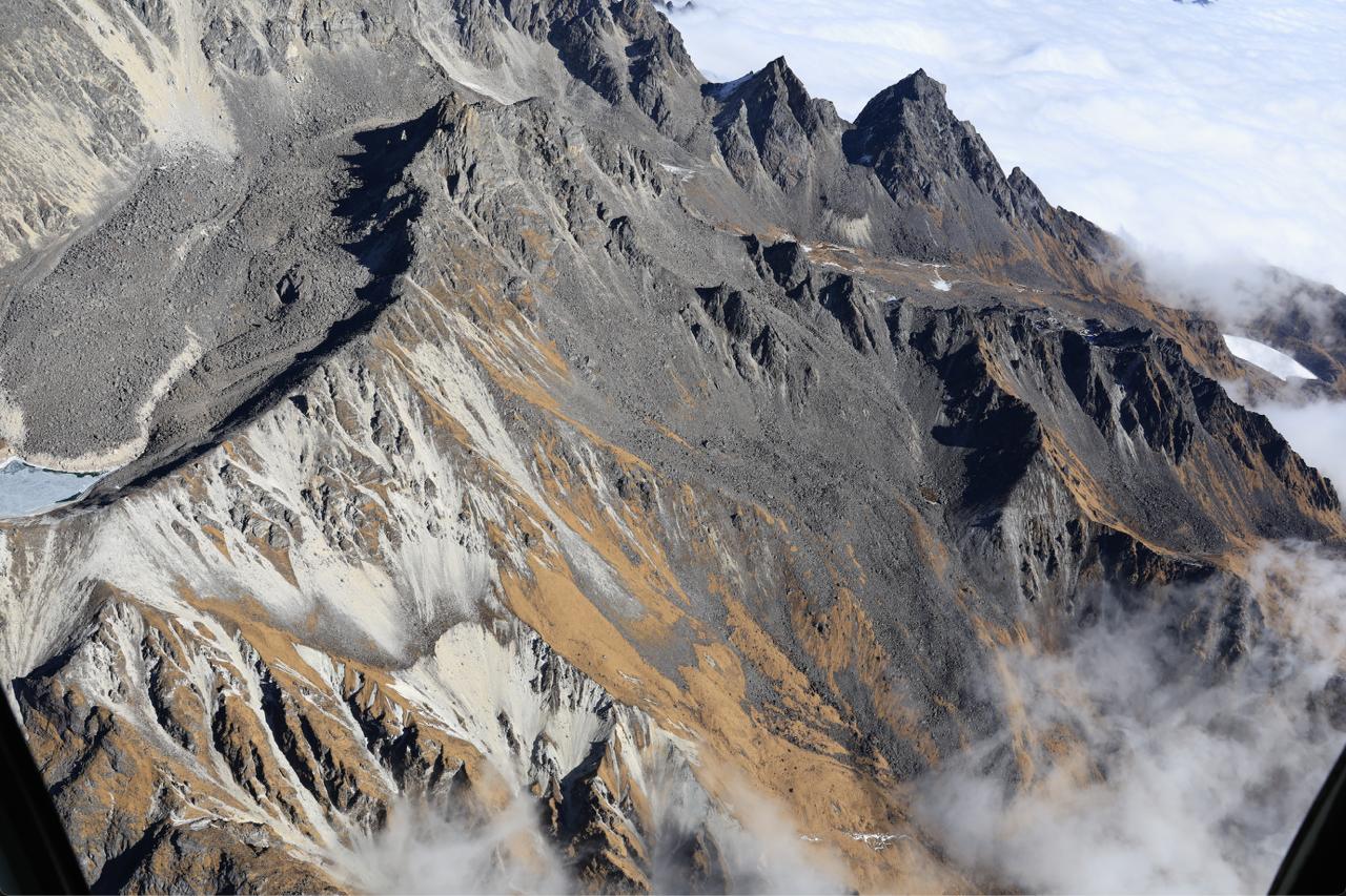
This is what the roof of the world looks like. I don't think anyone has seen what it looks like before for in the last few million years this was always under a blanket of white. 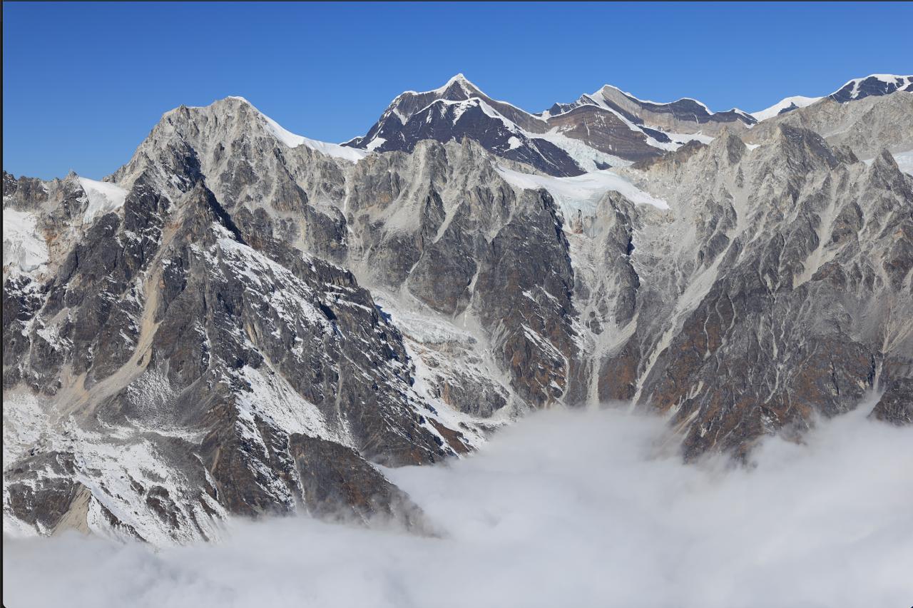
The Gorichen feature, with Gorichen Peak at 21,286 ft (6,488 m), a sacred mountain in the Eastern Himalayas, revered by the local Monpa tribe as a "Kingdom of Deity" (Sa-Nga-Phu). 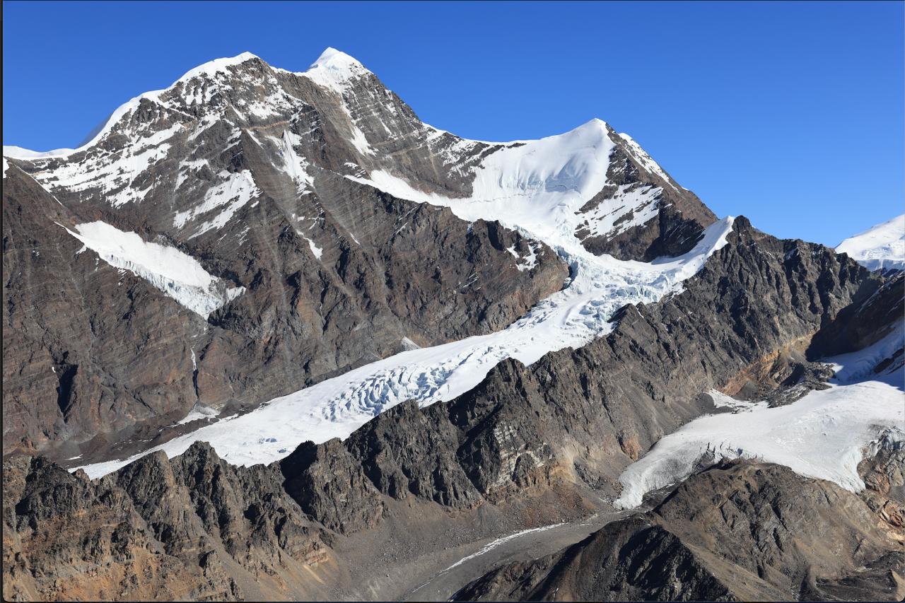
The Gorichen glacier. 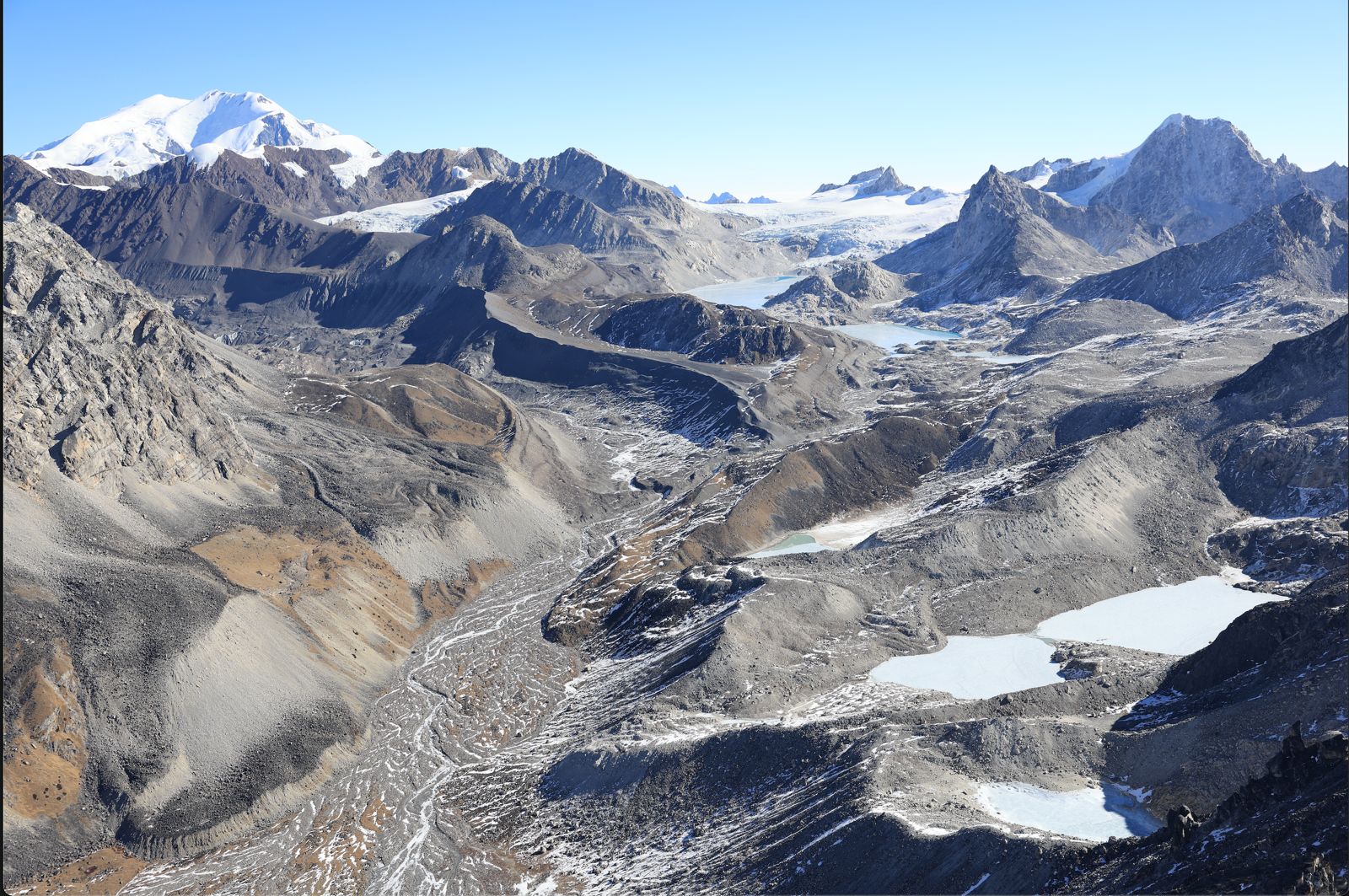
The eastern flank of the Gorichen glacier, Kangto in the background. 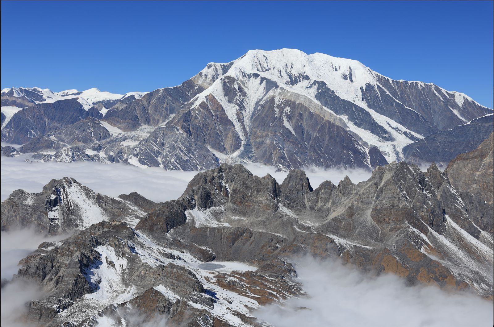
Kangto I… at 23,261 ft (7090 m) is the highest mountain in Arunachal. Kangto II is at 6953m… and the McMahon Line was drawn passing on the crest of these peaks. 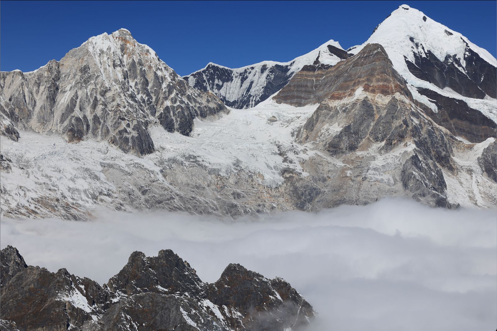
Chomo and Nyegyi Kangtsang (also called the Nyegyi Kangto) stand at 6878 m and 6953 m respectively and are the eastern edge of the combined massif. 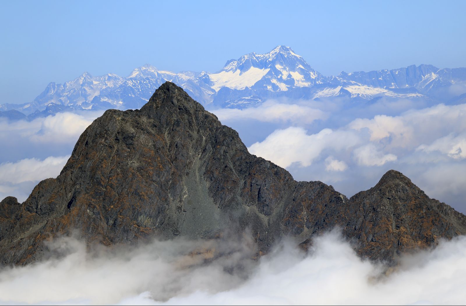
The Dacha Bum peak (4578 m - 15,020 ft) with the snow-capped area beyond Hayluiang visible in the background. The Namdapha River originates from here. 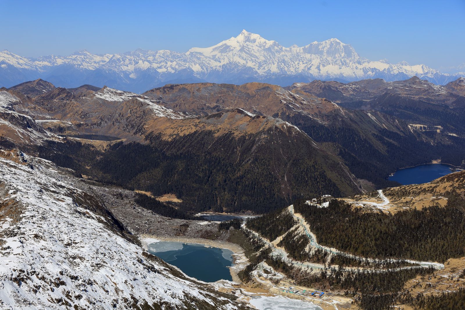
Across the LAC, Namcha Barwa (25,531 ft / 7,782 m) dominated the horizon, 36 nautical miles from where we were flying. From that height, three of the seven lakes on the Chinese side came into view.
Photographs and captions © Shiv Kunal Verma. The full McMahon Line essay
Field notes along the line, west to east (35)
- 1914 Simla Agreement. Behind every line on a map lies a human story. The 1913 Survey followed the watershed from Yonggyap La to Bum La, leaving the Trijunctions on either side unsurveyed. These photographs of Sir Henry McMahon, F.M. Bailey and H.T. Morshead, together with Bailey’s route across the Eastern Himalaya and the Simla Conference of 1913-14, recall the explorers, surveyors and diplomats whose work gave shape to the frontier that these pages have sought to document.
- Born of the great 1950 Assam-Tibet earthquake, the partly frozen Sangestar Tso lies at 3,708 m. beneath the high frontier. Beyond its northern watershed, the McMahon Line follows the crest towards Bum La, where geography quietly becomes history.
- At 4,633 m., Bum La has long been a gateway rather than a barrier. For centuries, caravans threaded this high pass linking Tibet and India. Today, the McMahon Line follows the same watershed, where an ancient corridor of trade and pilgrimage has become a modern international frontier.
- At nearly 5,162 m. near the trijunction of Bhutan, Tibet and India, a secluded alpine lake lies cradled beneath towering ramparts of rock. Just above, a second smaller reservoir together makes up the Tsangle Tso. On the right, the Nam Ka Chu river is born, beginning its historic 25 km. descent to its confluence with the Nyamjang Chu.
- Even at the height of winter, the Thagla Ridge, running east from the trijunction, is shockingly devoid of snow. Flowing between it and the Hathungla Ridge, the Nam Ka Chu became the stage for one of the bloodiest opening engagements of the 1962 Sino-Indian conflict.
- The approach to Tulung La, at 5,258 m. It was here that F.M. Bailey and H.T. Morshead briefly re-entered India from Tibet in 1913. Their journey, however, was far from over. Descending from the pass, they turned once more into Tibet, following the Nyamjang Chu before finally crossing into India again at Khinzemane. The landscape remains much as they would have seen it more than a century ago.
- South of Tulung La are Chuna and Mago, where sheer granite walls plunge into the Mago Chu valley. Born beneath these towering cliffs, the river becomes the Tawang Chu before flowing through eastern Bhutan and finally debouching onto the Assam plains as the Manas river.
- Our attempt to reach the Gorichen and Kangto massif on 20 January 2026 ended where the cloud began. Rising through the valleys beneath us, it erased the route ahead. At nearly 19,000 feet, with rotor efficiency already diminished by the thin air, pressing on was no longer an option.
- Tse La. The broad alpine saddle marks one of the principal watersheds of the Assam Himalaya. To the north, the land falls towards the Nyamjang Chu, while to the south countless streams gather beneath Gorichen, Kangto and Nyegi Kangsang before uniting as the Kameng river on its long descent to the plains of Assam.
- Our first glimpse of Gorichen, or Sa-Nga-Phu, the sacred guardian mountain of the Monpas. Rising to 6,488 m. (21,286 feet), the highest scalable peak in Arunachal Pradesh stands sentinel above the western frontier, its glaciers feeding the headwaters of the Kameng.
- Near the summit of Gorichen, frozen alpine lakes punctuate a landscape of weathered rock and ancient ice. At first glance, the striking feature is not the glacier itself, but the remarkable scarcity of winter snow across the surrounding plateau.
- Nyegyi Kangsang, east of Kangto and west of Takpa Shiri, completes the great arc of peaks enclosing the Kameng headwaters. Beyond this immense wall of ice and rock lies Tibet, its remoteness nurturing an aura of mystery that has endured for centuries.
- At 7,060 m. (23,163 feet), Kangto is the highest peak in Arunachal Pradesh and among the least known great summits of the Himalaya. Hidden for generations behind one of India’s most inaccessible frontiers, it remains a mountain seen by remarkably few.
- Unlike the great caravan routes further west, the upper Subansiri is crossed by little more than shepherds’ trails threading low passes between neighbouring valleys. These secluded highlands form the catchment of the Kamla river before it surrenders its waters to the Subansiri near Daporijo.
- The upper reaches of the Gorichen glacier. Scoured ice, exposed moraines and scattered tarns reveal a landscape shaped by glaciers over millennia, while the limited seasonal snow cover became one of the recurring observations made during the helicopter sorties.
- Kurt Cuffey (UC Berkeley) felt the images reflected an exceptionally dry winter across the Eastern Himalaya, while Joerg Schaefer (Lamont Doherty Earth Observatory, Columbia University) considered greenhouse-driven warming the more likely dominant influence. Both stressed that longer term meteorological and glaciological data would be needed before drawing firm conclusions.
- Suspended in the open doorway of an Advanced Light Helicopter at altitudes approaching 6,096 m., every photograph was earned against bitter cold and punishing wind chill. During February 2026, a rare spell of clear weather opened a fleeting window onto the highest frontier.
- The upper Subansiri carves one of the deepest gorges in the Eastern Himalaya. At the bottom of the valley lies Taksing, among the last permanent settlements before the Tibetan frontier. These remote mountains are home to the Na Tagin, whose lives have long been shaped by this formidable landscape.
- Longju first entered India’s strategic consciousness in August 1959, when one of the earliest armed confrontations with Chinese forces took place at the Assam Rifles post there. Further downstream, the Tsari Chu becomes the first major tributary to swell the Subansiri on its onward journey to the Brahmaputra and Majuli.
- The Sinjong Ridge forms more than a watershed. It separates the Subansiri basin from the Mechuka and Siang valleys while also marking a cultural frontier, where the Tagin homeland gives way to the Memba and Adi communities of the Eastern Himalaya.
- The Lamang Valley that is drained by the Yargyap Chu was once an important trading corridor linking southern Tibet with the Memba communities of Mechuka. Though its watershed lies lower than those of the Kameng and Subansiri, these mountains remain scarcely less isolated, preserving one of the Eastern Himalaya’s oldest cultural landscapes.
- Just inside Tibet, Namcha Barwa guards the eastern gateway of the Himalaya. Here the Yarlung Tsangpo makes its spectacular southward bend, echoing the Indus at Nanga Parbat thousands of kilometres away. Together, the two great syntaxes define the eastern and western anchors of the Himalayan arc.
- The remote headwaters of the Siyom rise beyond Monigong, where the McMahon Line traces the watershed between India and Tibet. The river descends through the Bokar country before receiving the waters of the Yargyap Chu from Mechuka and continuing south to meet the Siang.
- After carving the world’s deepest gorge around Namcha Barwa, the Yarlung Tsangpo enters India upstream of Gelling and Tuting, where it assumes the name Siang. On the right bank lies the Adi village of Bishing, one of the first settlements to greet the great river.
- Andra La has long linked the Siang and Dibang valleys, where the homeland of the Adis gives way to that of the Idu Mishmis. Here the Eastern Himalaya assumes an altogether different scale. Immense forests, empty valleys and scattered settlements combine to create one of India’s last great wilderness frontiers.
- Scattered across the high forests of the Eastern Himalaya, alpine lakes occupy glacial hollows carved over thousands of years. While some remained frozen through the winter, others reflected the clear mountain skies.
- Suspended beneath sheer granite cliffs, these glacial lakes are the quiet source of the Dri river. Their waters leap through a staircase of waterfalls before gathering the streams of Andra La and Yonggyap La, beginning the long descent through the Mishmi Hills towards the Brahmaputra plains.
- Unable to cross Andra La in 1913, Bailey and Morshead were forced eastwards to ingress into Tibet via Yonggyap La. More than a century later, photographed from the air in the same season, the valley presents a striking contrast. Where deep winter snow once cloaked these slopes, bare rock and alpine scrub now dominate the landscape.
- Pt 4388 dominates the right bank of the Lohit above Kibithu, where the ridge separates the Lohit and Dibang basins. Known in Tibet as the Zayul Chu, the Lohit even in Hindu mythology was believed to be the main source of the Brahmaputra, until surveys in the 1930s finally established the Siang as its principal headstream.
- After the Lohit enters India, the mountains rise sharply once again. Scattered among the granite heights are countless alpine lakes, their colours ranging from deep sapphire to pale turquoise. The partially frozen lake in the foreground is believed to feed the Pugga Chu, which descends past Hot Springs some two kilometres below.
- Nayam Tso is among the many spectacular glacial lakes that punctuate the McMahon Line. Seen from the air, its partly frozen surface resembles a sheet of black lava, an illusion created by ice, depth and crystal-clear water. Thin, transparent ice can act like tinted glass, allowing the dark depths below to dominate the image. The result can resemble obsidian or hardened lava.
- East of the Myanmar Trijunction, the great watershed continues towards China, but India’s frontier turns sharply south. Here the high Himalaya gradually dissolves into the forested ranges of the Naga Patkai, carrying the frontier onwards through Nagaland, Manipur and Mizoram.
- On a map, the Trijunction is merely a point where three frontiers converge. On the ground, it is a vast mountain wilderness of ridges, glaciers and watersheds. For over a century, the McMahon Line has been scrutinised by soldiers, surveyors and diplomats, though few had the opportunity to see the terrain that gave birth to it.
- The journey ends where the Himalaya slowly yields to the Naga Patkai. Across these mountains, passes have always connected landscapes, cultures and rivers long before political frontiers came into being. The lines on maps may divide nations, but the living mountain system remains one. Its future rests in the willingness of those on every side of the frontier to preserve the fragile ecological balance they share.
- The Indo-Myanmar-Tibet Trijunction marks a dramatic change in direction. Here, India’s frontier turns sharply south along the Indo-Myanmar border, while the China-Myanmar boundary continues eastward along the diminishing crest of the Assam Himalaya.
Captions from the photo essay in Sanctuary Asia’s Fortress India supplement, August 2026. Read the issue